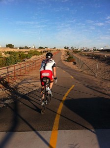
Pima County is working feverishly to complete several projects along the river path system before their Launch the Loop event on Saturday.
Check out the projects the county is hurrying along, but first, here’s more information about the event. Download the flier here.
What: Launch the Loop
When: Saturday Oct. 22 7-11 a.m. Dedication begins at 10 a.m.
Where: Registration sites: Flowing Wells District Park, 5510 N. Shannon Road; Christopher Columbus Park, 4600 N. Silverbell Road and Crossroads at Silverbell Park, 7548 N. Silverbell Road. The dedication ceremony will take place just west of I-10 on Sunset Road. You can, of course, get there on the path.
Rides: The event has several loosely organized rides. The main rides leave from Flowing Wells District Park around 7:30, 7:45 and 8 a.m. They will ride a 22-mile loop along the paths, through the University of Arizona, up Mountain Avenue and return to the dedication site. A ride from the Marana Library will leave at 9 a.m. for a 4-mile ride to the dedication site. Lastly a slower family ride will leave around 9 a.m. for a short ride to the dedication site.
Other: The registration sites will have free swag including; T-shirts, water bottles, backpacks, bike helmets for kids, and safety gear while supplies last.
Here are a few of the projects the county is rushing to get completed prior to the event on Saturday.
Poles
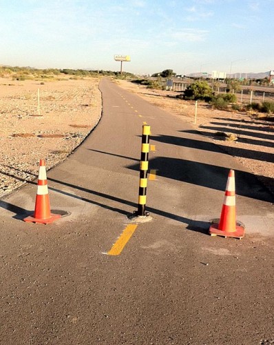
South bank of the Rillito
Pima County officials say they are planning on finishing two projects on the south side of the Rillito River between First and Campbell Avenues.
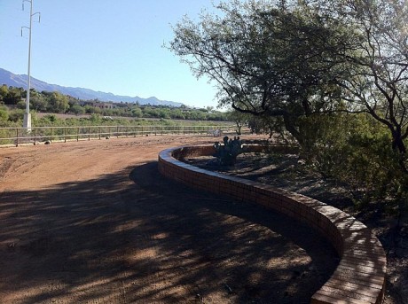
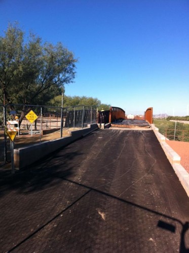
Heading north
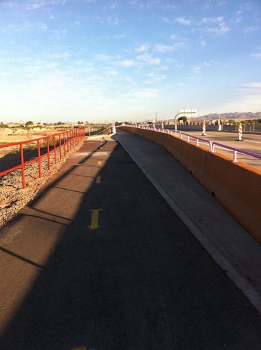
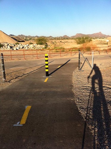
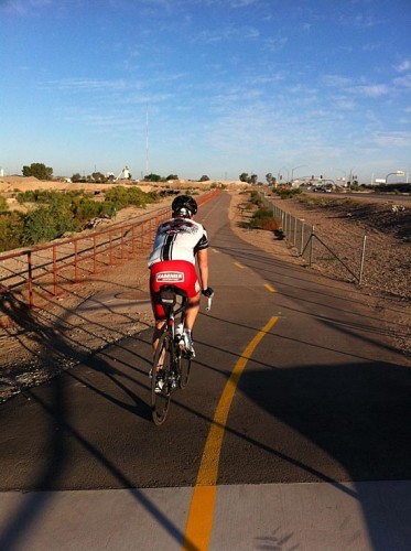
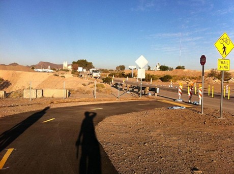
The biggest addition to the river park system is the connection of a series of paths between where the Santa Cruz and Rillito paths connect all the way up to Coachline and Silverbell Road. There are several locations along the way that require riding on surface streets, but for much of it, the system is separated from cars. Here is what it looks like:

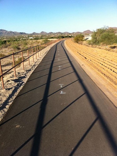
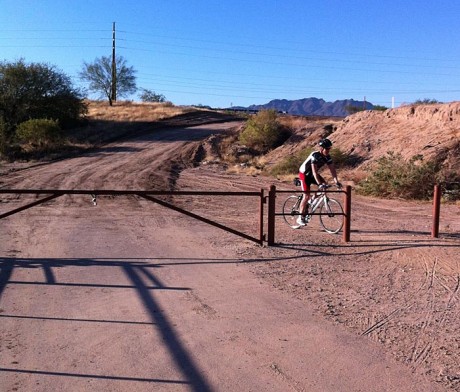
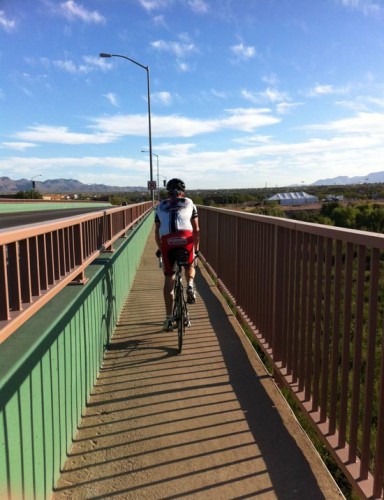
Many readers have been out riding the path recently. What do you think? Anything that I missed or things that still need some work?

After getting hit by a truck last year, I am thrilled to take parts of my ride off the streets. Thank you to everyone involved
They need to stripe the curb going onto the bridge over the Rillito. There is a chance of someone crashing by running off curb. See picture and you will see what I mean.
The route sounds very familiar. Is it the same one we rode not too long ago? Why aren’t we riding to Marana if that’s where the path is going?
Will they have the gate removed at Galleria Mall by then? I haven’t been on the South side path for a while, so I don’t know if it’s already been removed.
I’m loving the new improvements and give a big “Thank You” to everyone who had a hand in getting them done.
Thanks Jim, absolutely. We’re going to install ped rail on the top of that curb to direct folks to the ramp. On an inspection about 2 1/2 weeks ago I asked our project manager to address that as well as the crossing over the CDO.
I’ve requested that 3Wheeler and we hope to replace the gate with a center bollard and two outside bollards placed 6 feet from the center one. The Launch the Loop ride will use the north side of the path so the gate won’t cause a problem for that. However, we’d definitely like to replace the gate so we’ll keep after that and hopefully it will happen within a reasonably short time. Thanks for the comments and compliments–it’s a great group of folks working on this and I just try to mostly stay out of the way.
Frank, you basically enter Marana town limits some distance north of the Rillito. From there north it’s all Marana.
Thanks for the info, Matt. My trike doesn’t fit thru the zig-zag next to the gate so it’s a buster for me. I’ll be glad when it’s gone.
Love the path, looking forward to more new additions soon. The route of the ride and various alternatives confuse me. The Connect2 ride materials were easier for me to understand. Looks like I’ll be riding pretty far north to ride in not a complete circle and riding home again to the south. Am I wrong or is it true that if you ride from Flowing Wells Park to the dedication site you will not actually go under the interstate?
On a related but different pathish topic. I really wish the weekend riders on the Rillito path would slow down and pass more courteously. Multi Use Paths are not really an appropriate place to train unless you’re a runner. I’ve really enjoyed the solitary south bank section between Mountain and 1st Ave. The bridge transition is too slow for the lancealikes so they stay on the north.