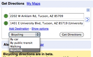
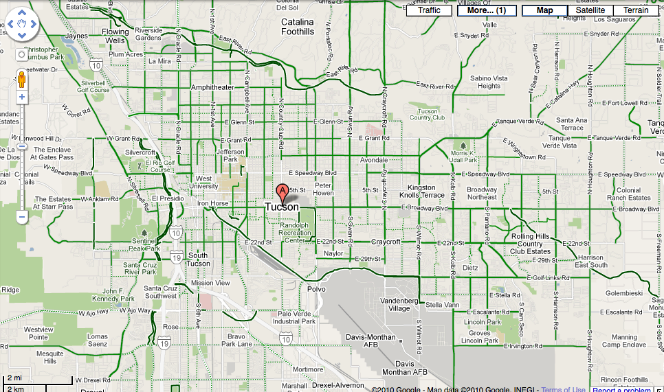
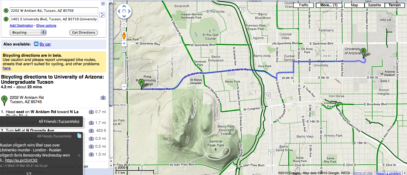
 Tucson is one of the 150 cities who can now use Google Maps to “bike there.”
Over 51,000 cyclists signed an online petition to have Google add the feature to the site.
Rumors started swirling when Jonathan Maus of BikePortland.org announced that an official from Google would be speaking at the 10th Annual National Bike Summit. Maus later confirmed that the announcement would indeed be the addition of bicycling directions to Google Maps.
The feature went live Wednesday evening.
Given how popular cycling is in Tucson, it makes sense that we were one of the 150 cities included in the initial launch.
I’m not sure how useful it will be to established Tucson riders, though. I suspect it will be most helpful to visitors and people who are considering riding somewhere for the first time.
It would be great if it became a tool to get new riders on the road by showing them there are facilities to get them from point A to point B.
I only experimented with it a little bit because I am working on another story this morning, but it looks like the default is to take you the most direct route rather than trying to keep you on less traveled streets.
I tried getting from the Campbell and Limberlost area to the UA using the bicycling directions. It had me take Mountain all the way down to the UA, which makes sense.
When I moved the start point closer to First Avenue, it took me down First Avenue rather than using Mountain again.
I tried to embed a map into the site to let you check it out, but for some reason you can’t embed the bike maps yet. Hopefully, that will change.
Instead, I recorded a quick screencast showing how it works:
TucsonVelo.com checks out Google Maps’ bike feature from Mike McKisson on Vimeo.
Here are a few screen shots I took:
Check it out and let me know what you think in the comment section.
Update: Here is the link to Google’s own blog describing the feature. They say they weight bike trails heavily and try to route you on those, but I didn’t see that happening.
This link has the entire list of cities.


Great news from Google! Thanks for the video demo, too. Google will be even better when they add the Arizona Trail, perhaps someone from Tucson will send them the gpx file. Of course, all the other Tucson area mountain bike trails should be added too!
Great news from Google! Thanks for the video demo, too. Google will be even better when they add the Arizona Trail, perhaps someone from Tucson will send them the gpx file. Of course, all the other Tucson area mountain bike trails should be added too!
That is awesome! Like you said, I probably won’t use it regularly since I have already established routes I like to the places I frequently go… but every now and then an errand takes you someplace new and this seems like a great tool. woohoo!
That is awesome! Like you said, I probably won’t use it regularly since I have already established routes I like to the places I frequently go… but every now and then an errand takes you someplace new and this seems like a great tool. woohoo!
And of course it will be useful when we go visit new cities where we aren’t familiar with the streets.
And of course it will be useful when we go visit new cities where we aren’t familiar with the streets.
Very cool! I reported a problem with the missing 3rd st rut from stone to alvernon. And now we’ll see how responsive they are with edits and feedback.
Very cool! I reported a problem with the missing 3rd st rut from stone to alvernon. And now we’ll see how responsive they are with edits and feedback.
I wonder if they rushed this? Here is a local project cyclopath.com which gave a much better route.
http://img706.imageshack.us/img706/8354/gmap2.jpg
and google who choose a couple bad roads, rerouted me way around things, and doesn’t even show the Luce Line. Granted the trails are still icy and I will stick with the main roads.
http://img169.imageshack.us/img169/3453/gmap.jpg
Very cool indeed. I “tested” the site to see where it would take me compared to my usual route from Sabino Canyon to the UofA. It was pretty much identical. Impressive.
Very cool indeed. I “tested” the site to see where it would take me compared to my usual route from Sabino Canyon to the UofA. It was pretty much identical. Impressive.
“but it looks like the default is to take you the most direct route rather than trying to keep you on less traveled streets.”
Play with the walking directions (left hand side, drop-down menu) and you might find routes that keep you away from crazytown.
“but it looks like the default is to take you the most direct route rather than trying to keep you on less traveled streets.”
Play with the walking directions (left hand side, drop-down menu) and you might find routes that keep you away from crazytown.
I was ecstatic to hear the news! Been waiting for this feature for a long time. Before I was always sort of combining the car/pedestrian directions. Since I bicycle tour through a lot of different cities, this feature is going to be extremely helpful in those situations.
Tried it out for a 14 mile ride today in Chicago. It was really helpful and gave me multiple route options. One was more direct and another was longer, but initially took me away from traffic on the lakefront path and then reconnected me to the city streets.
Also, it looks as though the bicycle map of Chicago is overlaying the Google map as bike friendly streets are highlighted across the city.
Lauren, thanks for commenting. I can see how it would be very useful when you are on tour. I think it has a ton of potential and imagine it will only get better.
It is good to hear that it is working in a real world application.
I think I might have to head to Portland, just to check it out in another city. I should be able to write that off as a business expense, right?
Red Star doesn’t understand why we don’t contact the relevant Google product manager on this and tell him/her this is what we like, this is what we don’t like, here are changes we like, improvements maybe, blah blah…
Why so scared?
Red Star doesn’t understand why we don’t contact the relevant Google product manager on this and tell him/her this is what we like, this is what we don’t like, here are changes we like, improvements maybe, blah blah…
Why so scared?
[…] tried Google’s “bike there” feature to suggest a route from my hotel to Venice Beach and then verified the route with a […]
[…] feature to their mapping tool. Tucson was one if the cities included in the original launch. Check out this post to see how it works and plan your […]