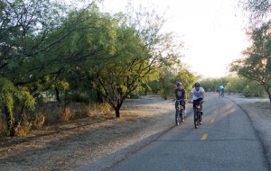
 The work of several Pima County bike advocates to create an urban loop path around the city is starting to pay off.
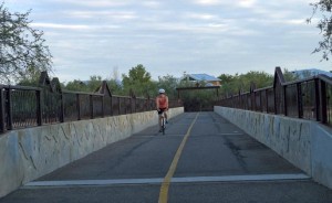
The loop, portions of which are under construction now, will connect shared-use paths like those that run along the Rillito and Santa Cruz rivers.
Matt Zoll, the county’s bike and pedestrian program manager, said a vocal contingent of citizens including Norm Land and Roy Schoonover, have elevated the priority of the project dubbed “The Urban Loop” within the county administration.
“It is a labor of love,” Schoonover said.
Slusser said their dedication has moved the project forward.
“They are very persistent,” said Nanette Slusser, the county’s assistant county administrator for public work. “They got to the county administrator — this was his dream anyhow — but made him see we needed to focus a little more on it.”
Pima County administrator Chuck Huckelberry has said he wants the Urban Loop to be one of the projects he completes and is remembered for.
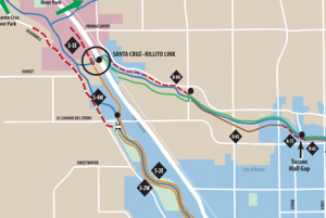
 The loop utilizes the existing paths along the Rillito and Santa Cruz rivers, while filling in gaps between the two. The plan also includes adding paths along the Julienne wash on the south side of Tucson and the Pantano wash and Houghton greenway on the east side. Eventually, the paths will be connected to create the loop. Click the image to the left to see the full map on the county’s website with detailed information about each connection.
According to Slusser, who is overseeing the project, the goal is to have one side of the path done for the entire 55 miles as soon as possible.
“I would guess within 10 years, the whole thing will be done,” Slusser said. “I’d love to make it within five years, but I don’t know that I could come up with the money that fast.”
Although the loop’s completion is still years away, several projects are currently being designed or built.

According to Slusser, in the next few months the Rillito path, which currently ends at Interstate 10, will connect to a maintenance path along the Santa Cruz that ends just before Camino Del Cerro.
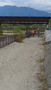
The county recently began the process of hiring a construction company to build the portion of the Santa Cruz path from Grant Road north to Camino del Cerro. But like several sections of the loop, the connection between the two won’t be made soon.
According to Slusser, there are several other locations along the loop that are going to be very challenging to keep bikes and pedestrians separated from cars, including a 2-mile section they are calling no man’s land. That area is located along the Pantano wash between Houghton Road and Sellarole Street.
“That is the hardest part right now for us to connect to,” Slusser said. “We have tons of unstable soils out there and we’d have to do very extensive soil stabilization or buy some property and move it way back from the river.”
Until those connections are made, Slusser said the loop isn’t that useful.
“Right now it is pieces of a loop,” Slusser said. “It is kind of frustrating unless you are a weekend rider who doesn’t go real far. You don’t get much of a real experience on it right now.”
But Zoll said once the loop is finished it has the potential to be an international draw.
“It is another international thing we would be known for in attracting people to Tucson,” Zoll said.
At this point, Zoll said he sees the loop as being largely for recreational rides, but could see it benefiting commuters as more and more links are made from the city to various parts of the county.
Conrad Nunez said he rides the Rillito bike path at least once a week and is excited about the prospect of being able to go farther. He prefers the path to riding in traffic.
“It is more laid back and it isn’t dangerous,” Nunez said. “The scenery is a little bit better than watching out for some big guy in a truck trying to hit you.”

Susannah Sanchez said she feels safe riding with traffic, but has friends who don’t.
“I think these paths make people want to ride,” Sanchez said. “They feel safer than in the city.”
Sanchez would said she would likely use the path for recreation rather than for commuting.
“I think it would be good for training especially,” Sanchez said. “You wouldn’t have to deal with the traffic and the stops.”
According to Zoll, as more projects and connections are made it should become easier to secure funding and complete more sections of the loop.
“Success breeds more successes,” Zoll said.
Slusser said the county needs $70 million to finish the loop.
According to Slusser, the county has used money from several pots including the RTA, Federal Transportation Enhancement grants, flood control projects and developers who are building along the rivers.
Slusser said the county is also considering creating a bond item and has applied for a federal Tiger II grant.
“We are just scrambling around,” Slusser said. “Any money that is hiding anywhere, we try to track it down and put it to good use. It is hard in this market to find excess funds, but we have been lucky with under-budget projects.”
Check the progress and status of the various path segments at Pima County’s Urban Loop site.

“At this point, Zoll said he sees the loop as being largely for recreational rides, but could see it benefiting commuters as more and more links are made from the city to various parts of the county.”
I'll be waiting patiently for this to come true. “Recreational rides” is code for “people who have money.” I like the urban loop, but I'd prefer a few boulevards to help me get to work.
I use these paths a lot! Its a really great way to have an undisturbed long ride and also a good resource for a family bike ride. I jump on at Craycroft & River and head south to La Cholla. That's where I have to stop right now due to construction. It is a wonderful ride & it sounds like its going to get even better!
I also ride these paths a lot. I ride it to work and back every day and hop on it whenever we're going in the same direction around town. It's safe and beautiful. Are there any plans to connect it to the Rio Neuvo project? Maybe it can find some funding there.
The Rillito bike path is the best. I ride it 2-3 times a week, even though I live miles from it. If I had a job that was close to the Rillito, it would probably be the only asphalt I touched. Ok maybe that is an exaggeration, but there are so many things on or near this path. The Racquet Club, Trader Joe's, all the stores near Oracle or Stone and Rillito, Brandi Fenton Park (dog park!). Then the connection via Mountain Ave to the University and 4th Avenue area. Yay!
I'm glad they're paving the next section on the Santa Cruz. It would be a cool bike trip for kids going to the 4-H high ropes course and “GreenLot” which is right up at Prince and the river. Right now the only way for people to get there is either by mountain bike or I-10 frontage road.
It would also connect people who were further northwest to downtown, United Way/Tucson multi-use building, Pima Community Campus, etc. There are quite a few commuter destinations along or near this route. I'm sure people living further to the south and to the east can think of things that the rest of the loop would link…
It's awesome that this is happening! With Fontana/4th Ave Bike Blvd improvement happening this year and hopefully Treat Ave will be next in becoming a Bike Blvd. So we can crisscross the city! I also look forward to Liberty St portion of 10th Ave/Liberty St. Bikeway becoming a Bike Blvd. I also look forward to two streets along Grant Rd becoming Bike Blvds as well.
From the Bureau of Fragmentation: to Red Star, one problem with Huckleberry's Loop is the lack of attention paid to the segment running from 22nd all the long and winding way to Craycroft, specifically the Pantano Wash segment between Broadway and Speedway. Of course, surprise, surprise there is a Superfund site lurking thereabouts and that scares sensible developers who might otherwise be amenable to funding infrastructure, no matter how much Huckleberry's Nannette distracts us from it by babbling about Houghton.
http://www.azdeq.gov/environ/waste/sps/images/b…
These are the facilities that avoid intersections
and if enough applicable routes can be
completed, would be the commuters choice
of travel. Many quotes bear that out.
The people with high-end bikes are out
recreating on the highways….very few on
the paths as they are just too slow.
And many thanks to the BAC representatives
involved in the continual push to get
these facilities completed!
The plans are a great idea, but the existing paths are not maintained. Example: Rillito path is a multi-use path but it is unusable for people wanting to inline skate from Cambell to La Cholla. Pavement is rough and falling apart. Even when biking there are places that are as bad as some of the city streets. City engineers need to come up with a better asphalt mix
that is more durable.
[…] The fight over bike boulevards — which has created some dissension among BAC members — has largely focused on how the projects will be funded, skepticism about their effectiveness and delayed completion and funding of other projects like the Urban Loop. […]
[…] The area is located at I-10 and Orange Grove Road and is at the intersection of the Santa Cruz, Rillito and Canyon del Oro rivers, which Slusser said will make a good connection for the Urban Loop. […]